
Richland County ZIP Code Coverage
The Census 2020 ZCTA-to-county relationship file identifies 25 Census ZCTAs with land in Richland County. A ZCTA approximates a ZIP service area. It does not mean every address receives that ZIP, and it does not name a post office for every location. The county sources reviewed do not publish an exhaustive ZIP-to-post-office inventory. For that reason, the post-office column below is deliberately labeled verify with USPS rather than guessing a station or delivery route.
| ZIP | Areas Covered | Post Office | Notes |
|---|---|---|---|
| 29016 | Partial ZCTA land in Richland County | Verify with USPS | About 90% in county; compare GIS and address result |
| 29036 | Partial ZCTA land in Richland County | Verify with USPS | About 28% in county; cross-county area |
| 29044 | All reported ZCTA land in county | Verify with USPS | Address-level ZIP still needs confirmation |
| 29045 | Partial ZCTA land in Richland County | Verify with USPS | About 33% in county; cross-county area |
| 29052 | All reported ZCTA land in county | Verify with USPS | Address-level ZIP still needs confirmation |
| 29061 | All reported ZCTA land in county | Verify with USPS | Address-level ZIP still needs confirmation |
| 29063 | Partial ZCTA land in Richland County | Verify with USPS | About 97% in county; cross-county area |
| 29075 | Partial ZCTA land in Richland County | Verify with USPS | About 27% in county; cross-county area |
| 29078 | Partial ZCTA land in Richland County | Verify with USPS | About 11% in county; cross-county area |
| 29130 | Partial ZCTA land in Richland County | Verify with USPS | About 1% in county; do not assume city or county |
| 29177 | All reported ZCTA land in county | Verify with USPS | Very small statistical ZCTA |
| 29180 | Partial ZCTA land in Richland County | Verify with USPS | About 4% in county; small overlap |
| 29201 | All reported ZCTA land in county | Verify with USPS | Address-level ZIP still needs confirmation |
| 29203 | All reported ZCTA land in county | Verify with USPS | Address-level ZIP still needs confirmation |
| 29204 | All reported ZCTA land in county | Verify with USPS | Address-level ZIP still needs confirmation |
| 29205 | All reported ZCTA land in county | Verify with USPS | Address-level ZIP still needs confirmation |
| 29206 | All reported ZCTA land in county | Verify with USPS | Address-level ZIP still needs confirmation |
| 29207 | All reported ZCTA land in county | Verify with USPS | Address-level ZIP still needs confirmation |
| 29208 | All reported ZCTA land in county | Verify with USPS | Very small statistical ZCTA |
| 29209 | All reported ZCTA land in county | Verify with USPS | Address-level ZIP still needs confirmation |
| 29210 | Partial ZCTA land in Richland County | Verify with USPS | About 70% in county; cross-county area |
| 29212 | Partial ZCTA land in Richland County | Verify with USPS | About 31% in county; cross-county area |
| 29223 | All reported ZCTA land in county | Verify with USPS | Address-level ZIP still needs confirmation |
| 29225 | All reported ZCTA land in county | Verify with USPS | Very small statistical ZCTA |
| 29229 | All reported ZCTA land in county | Verify with USPS | Address-level ZIP still needs confirmation |
“All” describes the ZCTA’s reported land relationship to the county. “Partial” means the ZCTA crosses a county line. The table is a geography index for a Richland County ZIP code directory, not a promise about delivery for an individual address.
Verify a Richland County ZIP Code First
The USPS ZIP Code Lookup is the authoritative starting point for a specific mailing question. Its three lookup modes keep different tasks separate. Use the address mode to validate the address in hand. Use the city-and-state mode to see ZIPs USPS associates with that locality. Use the ZIP mode to see cities covered by a ZIP. None of those postal outputs establishes a parcel boundary, municipal jurisdiction, or current resident.
| USPS control | Best use | What it does not establish |
|---|---|---|
| ZIP Code by Address | Checks a street address with city and state, or address with ZIP | County, city-limit, or parcel jurisdiction |
| City and State | Returns ZIPs for a city and state input | A complete county land area |
| Cities by ZIP Code | Returns cities USPS lists for a ZIP | That all listed places are within one local government |
Keep the returned address exactly as USPS presents it. That makes the next map and parcel searches less likely to split a unit number, street type, or mailing convention into an avoidable false result.
Richland County ZIP Code Map Layers
Richland GIS has a Dataviewer that searches by address or parcel and offers parcels, addresses, zoning, subdivisions, tax districts, municipalities, ZIP codes, voting precincts, voting locations, and council districts as layers. This is the county’s key geography tool. A ZIP boundary becomes much more useful when it is viewed beside the parcel and jurisdiction layers that govern the next records search.
The official GIS Dataviewer displays the Richland County ZIP code layer alongside the related local boundaries.
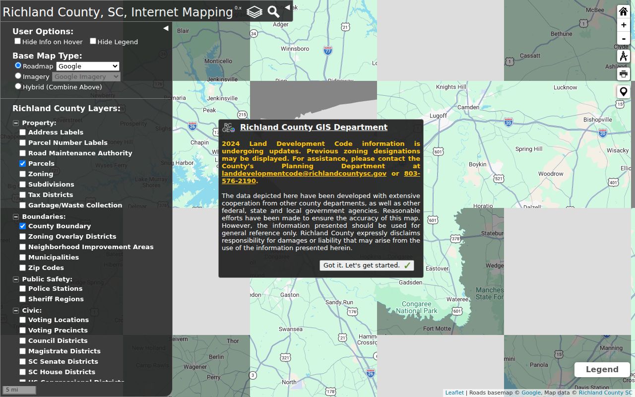
Turn on a ZIP layer for orientation, then add municipalities, parcels, subdivisions, or voting layers only for the question at hand. The map is a browse and visual-context tool. It is not a documented ZIP-filtered export of people or parcels.
Richland County ZIP Search Controls
A ZIP code directory cannot turn every local portal into a ZIP search. The county Property Record Card is keyed to a tax-map number, address, or owner, with advanced filters for tax district, neighborhood, characteristics, and transaction dates or prices. It has no documented ZIP search or ZIP filter. The Register of Deeds supports names, file dates, property address, legal description, and book or page routes, but does not publish a ZIP mode. City Access is address or TMS keyed and only returns City-valid addresses.
| Portal | Documented key or control | ZIP limitation |
|---|---|---|
| Property Record Card | TMS, Address, Owner; Tax District, Neighborhood, and property/date filters | No documented ZIP filter |
| GIS Dataviewer | Address or parcel search plus ZIP Codes layer | Visual layer, not a ZIP-filtered people or parcel export |
| Register of Deeds | Instrument number, name, file date, property address, legal description | No published ZIP mode |
| City Access Portal | Street number and name, or TMS format 00000-00-00 | Not a ZIP directory; City-valid addresses only |
| MyscVOTES | Individual registration path and precinct information | No public name-only ZIP roster |
These limits prevent a ZIP-wide owner or resident list from being honestly promised. Narrow the actual address first, then use its TMS and legal description for parcel and recorded-land research.
Finding Residents Within a Richland County ZIP
Use a ZIP code to narrow geography, not to claim a complete list of people. Start with a precise mailing address, confirm its postal ZIP, and inspect its map context. Then search the parcel record by the real address or TMS. That sequence preserves the difference between a delivery area, an ownership record, and a public map. Once a ZIP has narrowed the area to a street, the address-level procedure is explained in the Richland County street directory.
- Check the full mailing address in USPS ZIP Lookup and record the returned ZIP and city wording.
- Search the same address or parcel in Dataviewer, then compare the ZIP layer with municipality, parcel, subdivision, tax, and voting layers.
- Open the Property Record Card by address or TMS. Keep situs, owner mailing address, legal description, and TMS as separate fields.
- Use the sale-history book and page or recorded-party information to continue to the Register of Deeds when a land-transfer question remains.
- For historical context, check dated directory, map, or obituary sources at the Walker Center instead of treating a current ZIP as a historic street identifier.
Note: A mailing ZIP is a valuable check, but the TMS and legal description are more reliable bridges from a current parcel to recorded land history.
Richland County Parcel Keys After a ZIP
The Richland GIS Property Search Beta describes a map, imagery, Street View, and tabular property-information route. After a ZIP has oriented the search, the exact address or parcel becomes the working key. Property research uses three distinct local fields: the situs address for the physical parcel, the owner mailing address for tax correspondence, and the legal description or TMS for the property record. A mailing address does not prove occupancy, and a ZIP label does not establish municipal jurisdiction.
The county property-search application provides the map and tabular context used after a Richland County ZIP code search is narrowed to a parcel.
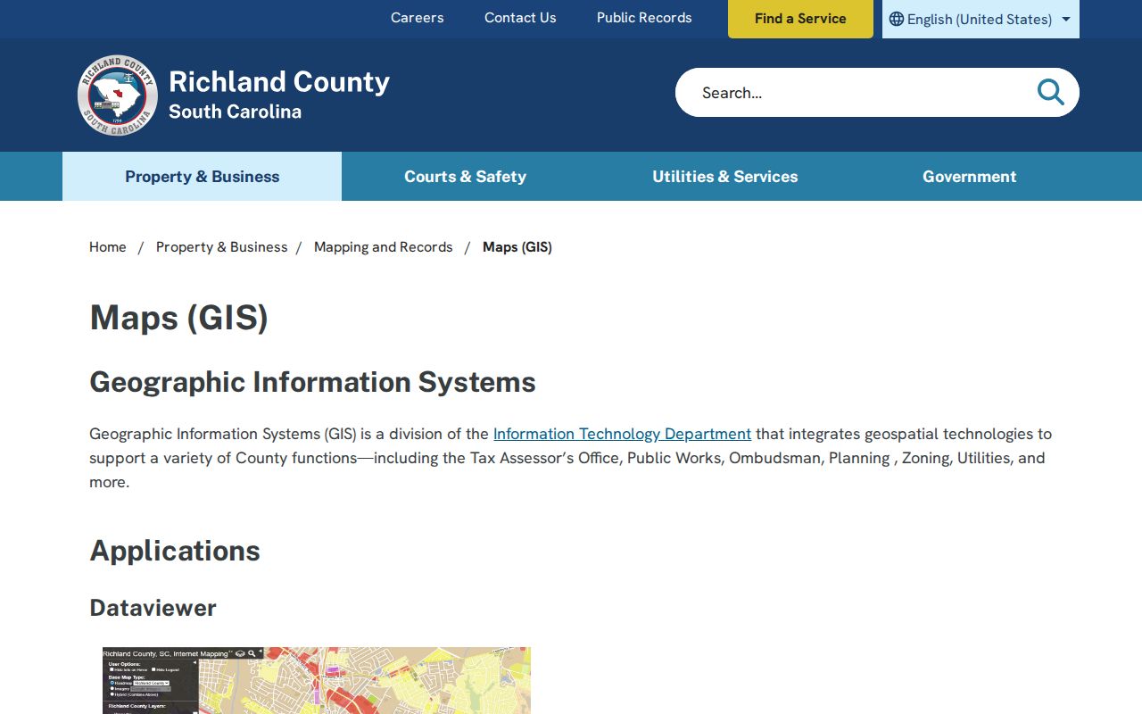
The property card can lead to sale-history book and page, grantor, grantee, transaction date, and price. A recorded instrument may not carry a street address or tax-map number, so a search can require the legal description, date range, or party names. Older land research can require the Register of Deeds counter, public viewer, microfilm, or historic books.
ZIP Codes and Richland County City Limits
Postal geography and local jurisdiction do not use the same lines. Several Richland County ZCTAs cross county lines, and city mailing names can overlap county and city boundaries. Columbia’s planned-grid history explains why older street and avenue sources can be useful, but it does not make a current ZIP a historical street map. Compare the mailing result, GIS municipality layer, TMS, and legal description before deciding which county or city office has a record.
- ZIP
- A postal delivery code. It can cover more than one locality and does not define a county or municipal boundary.
- ZIP+4
- An added four digits that USPS uses to narrow delivery routing beyond the base ZIP. It is not a parcel number.
- PO-box ZIP
- A ZIP used for post-office-box delivery. It should not be assumed to describe a physical parcel location.
- Unique ZIP
- A ZIP associated with a single institution or other specialized delivery arrangement. Verify it with USPS for the actual address.
- Carrier route
- A postal delivery grouping used for mail routing. It is different from a legal parcel, census boundary, or resident directory.
South Carolina ZIP Record Boundaries
Use official postal and county map tools for family history, neighborhood curiosity, civic geography, property questions, and scam verification. A ZIP label does not open protected personal information. South Carolina’s Address Confidentiality Program can shield a participant’s future government-document mailing address, and the Family Privacy Protection Act limits commercial-solicitation use of personal information from government sources. The county Property Record Card also has a record-by-record online opt-out process under More → Opt-Out.
When a county administrative record is unavailable online, the Richland County Public Records route is available for eligible requests under the South Carolina Freedom of Information Act. That process does not displace court confidentiality, vital-record rules, protected addresses, or another custodian’s procedure.
Use records responsibly. Postal and map information is for lawful personal research. Do not use it to stalk, harass, threaten, surveil, or harm anyone.